 NERC Data Catalogue Service
Water supply
Type of resources
Topics
Keywords
Contact for the resource
Provided by
Years
Formats
Representation types
Update frequencies
Scale
-
This data was produced to support a project looking at low permeability rocks in sub-Saharan Africa. Multiple boreholes were drilled for the project with geology identified from chippings. Groundwater chemistry was analysed from the resulting boreholes. The data contained within this record is from the CD that accompanies the report: J Davies and B É Ó Dochartaigh. 2002. Low Permeability Rocks In Sub-Saharan Africa. Groundwater development in the Tabora Region, Tanzania. British Geological Survey Internal Report, CR/02/191N. 71pp http://nora.nerc.ac.uk/id/eprint/505608/1/CR_02_191N.pdf The CD has not been uploaded in full elsewhere.
-
The data includes field chemistry, major and minor ions (ICP-MS and IC), nutrients (DOC), and tracers (Tritium, CFCs, SF6, δ18O, δ2H, δ13CDIC) collected in Nigeria and Mali in 2010. There is a brief description of the source, depth and completion date of the borehole, type of pump, estimated village population and estimated rainfall. Work funded by UK Department for International Development.
-
This data was produced to support a project looking at low permeability rocks in sub-Saharan Africa. Multiple boreholes were drilled for the project with geology identified from chippings. Groundwater chemistry was analysed from the resulting boreholes. The data contained within this record is from the CD that accompanies the report: J Davies and J Cobbing, 2002. An assessment of the hydrogeology of the Afram Plains, Eastern Region, Ghana. British Geological Survey Internal Report, CR/02/137N. 66pp http://nora.nerc.ac.uk/id/eprint/505607/1/CR_02_137N.pdf The CD has not been uploaded in full elsewhere.
-

In developing countries, the dominant model for managing rural water supplies is a community-level association or committee. Although a relative paucity of evidence exists to support this model, it continues to exert a strong pull on policy makers. This project examines everyday water governance arrangements, situating these in the exigencies of wider village life and over the course of changing seasons. The data highlights the social embeddedness of water governance, and challenges the dominant 'associational model' of community based management. In none of the 12 sites do we observe a fully formed committee functioning as it should according to policy. Instead, water management arrangements are typically comprised by one or a small number of key individuals from the community, who may or may not be part of a waterpoint committee.
-
The Environment Agency and Natural Resources Wales have updated its groundwater vulnerability map to reflect improvements in data mapping, modelling capability and understanding of the factors affecting vulnerability. Two new maps are available which show the vulnerability of groundwater to a pollutant discharged at ground level. The potential impact of groundwater pollution is considered using the aquifer designation status which provides an indication of the scale and importance of groundwater for potable water supply and/or in supporting baseflow to rivers, lakes and wetlands. This dataset for Wales has shared intellectual property (IP) between Natural Resources Wales and British Geological Survey.
-

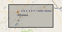
This dataset provides a detailed physical science dataset to the groundwater resource and engineering properties of 150 handpumped borehole supplies (HPBs) across Ethiopia, Malawi and Uganda, surveyed in 2017. The dataset includes measurements of aquifer resource potential, groundwater quality, downhole construction and condition of handpump components, and borehole construction. Detailed social science data were also collected as part of the second survey phases of the Hidden Crisis project. However, these data are reported as a separate (associated) dataset to the physical science Survey 2 dataset – and are available from Economic and Social Research Council (ESRC) UK Data Service (UKDS). The Hidden Crisis project (2015-20) was an international research project aimed at developing a robust evidence base and understanding of the complex and multi-faceted causes which underlie the current high failure rates of many new groundwater supplies in Africa. The project was jointly funded by: DFID, NERC and ESRC as part of the UPGro programme. The project carried out the research work in three countries - Ethiopia, Malawi and Uganda – to examine functionality and performance of groundwater supplies in a range of hydrogeological, climatic and social, institutional and governance environments in East Africa. The work focused specifically on examining the functionality of HPBs – these being the main form of improved community water supply across rural Africa. The Survey 2 dataset, is major dataset developed by the project.
-
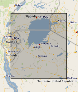
Data for Uganda includes analytical, field, isotope and borehole data. Data for Tanzania includes chemistry, field, isotope and borehole data. Borehole data from the Makutopora Wellfield is also included. This data was collected to investigate the resilience to climate change in sub-Saharan Africa (Tanzania and Uganda) of intensive groundwater abstraction from weathered crystalline rock aquifer systems. The sustainability of such abstractions was investigated by examining historical aquifer responses to climate and intensive (> 1 l/s) abstraction, and investigating groundwater residence times at sites of intensive groundwater abstraction using multiple tracers. The project was DFID funded. Project partners include: University College London, the British Geological Survey and the Overseas Development Institute
-
Oju/Obi is a remote part of Eastern Nigeria. There are severe water shortages during the 4-5 month dry season. The hydrogeology of the area is complex, and groundwater is difficult to find. In an attempt to understand and quantify the available groundwater resources within the area, DFID commissioned BGS from 1997 – 2000 to carry out a hydrogeological review of the area and devise appropriate and effective methods for siting wells and boreholes assessing groundwater resources and how best these resources could be developed. The field study involved the collection of time series data including groundwater chemistry and rainfall Cl along with mineralogical information. These results are being used by WaterAid, Local and regional Government to help local communities develop sustainable water supplies.
-
**THIS DATASET HAS BEEN WITHDRAWN** Ethiopia experienced severe drought in 2015-16. Many rural communities experienced declines in the performance of their water supply systems. As a result UNICEF commissioned a real-time monitoring and responsive operation and maintenance programme for point source rural water supplies across Central, Northern and Eastern Ethiopia. The water point monitoring survey was coordinated by UNICEF and conducted by World Vision Ethiopia and Oxfam Ethiopia. Data was collected between January and May 2016. Akvo Flow, a mobile survey tool, was used to collect data using questionnaires which were completed by enumerators and uploaded to central servers in near real time. The dataset includes data on functionality, access, usage and water quantity from 5196 rural water points. UNICEF provided the dataset to BGS. BGS reorganised, cleaned, and conducted quality control and analysis of the dataset. A companion paper has been published with more details of the methodology and results of the monitoring survey, https://doi.org/10.1038/s41467-020-14839-3
-
These files include hydrochemical data and groundwater level time series for a number of boreholes and wells within the basement aquifers of the Romwe catchment. For each borehole/well there are associated depth, geology and use data. A time series study of abstraction was also carried out for a subset of wells. Time series rainfall data for a rain gauge in the catchment is also included. These data were collected through a series of projects: Small scale irrigation using collector wells: pilot project (CEH/BGS/Zimbabwe Ministry of Lands, Agriculture and Water Development; DfID funded) Sustainability of yield from wells and boreholes in hard rock aquifers (BGS; DfID funded) Regional groundwater recharge assessment in semi-arid areas (CEH/BGS; DfID-funded) The Hydrology of a dry land catchment in southern Zimbabwe, and the effects of climatic and land use change on shallow groundwater resources (PhD project, Uni. Reading/CEH) Integrated Catchment Management and Sustainable Water Resource Development in Semi-arid Zimbabwe (PhD project, Uni. Reading/CEH) Note: CEH (Center of Ecology and Hydrology) was known as ‘IH’ during the period of the study